
Richards Town, Bengaluru, still has its “conservancy lanes,” narrow back lanes behind the big bungalows that once let workers reach the houses for cleaning and other chores without using the front gate. Only a few Bengaluru neighbourhoods, including Basavanagudi and Malleswaram, have this feature, and it’s a small reminder of how carefully the Cantonment’s colonial suburbs were planned.
The neighbourhood is named after F.J. Richards, and his family’s influence goes beyond this one area: Mrs F.J. Richards laid the foundation stone of neighbouring Frazer Town in August 1910. Here’s where Richards Town sits, how to get around, and what’s close by.
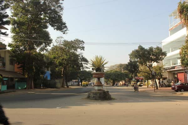
Richards Town at a Glance
| Detail | Information |
| Named after | F.J. Richards, President of the Civil and Military Station Municipality (1908–1912) |
| Developed | Late 1800s and early 1900s |
| Planning style | European, with broad roads built for horse carriages |
| PIN code | 560005 |
| Post office | Frazer Town |
| Landmark park | Richards Park |
| Landmark church | Holy Ghost Church (opened 24 May 1953) |
| Nearest railway station | Bengaluru East, about 1 km |
| Upcoming metro | Tannery Road (Pink Line), about 2 km |
Who Was F.J. Richards?
F.J. Richards led the Bangalore Civil and Military Station Municipality from 1908 to 1912. He’s credited with:
- The Dairy Farm and Veterinary Hospital: Started on Queen’s Road.
- Ulsoor Lake: Improvements to Halasuru (Ulsoor) Lake.
- Richards Park and Richards Town: Both named in his honour.
His wife laid the foundation stone of Frazer Town in August 1910, and a commemorative plaque still marks the spot at the corner of Coles Road and Mosque Road.
What Gives Richards Town Its Character
- Colonial layout: Wide, tree-lined roads planned for horse carriages.
- Conservancy lanes: Service lanes behind the bungalows, rare in Bengaluru today.
- Old bungalows: A mix of colonial-era homes and newer apartment buildings.
- Peaceful streets: Residents describe it as quiet, with hospitals and banks within about 1 km.
Richards Park
The park is the heart of the neighbourhood. On weekends it’s busy, with horse rides and vendors, and one local newsletter compares the atmosphere to a village fair. Traffic around the park has increased in recent years, which has changed its once-quiet setting.
Holy Ghost Church
Holy Ghost Church opened on Pentecost Sunday, 24 May 1953, and was consecrated by Archbishop A.S. Colas of Pondicherry. It’s described as the largest parish in the Archdiocese of Bengaluru and holds regular weekly masses.
Getting Around Richards Town, Bengaluru
Rail
- Bengaluru East: About 1 km away, on the Chennai–Bengaluru line. Richards Town sits across the tracks from the station, and it’s a short walk from Richards Park.
- Banaswadi: Another nearby station for suburban and long-distance trains.
Metro: Tannery Road Station
- Station: Tannery Road, an underground station on the Pink Line, about 2 km away.
- Areas served: Mainly Richards Town, plus Lingarajapuram, St. Thomas Town, Cooke Town and Williams Town.
- Opening estimate: The station’s page expects the 13.8 km Dairy Circle–Nagawara section to open around December 2026. The Pink Line has missed earlier deadlines, and some line-wide estimates point to early 2027.
- Other stations: Pottery Town and Venkateshapura are also nearby on the Pink Line.
Buses
The RT Nagar Bus Depot and Satellite Bus Stand serve the area, with BMTC routes connecting Richards Town to the rest of the city.
Tannery Road
Tannery Road is 4 km long, about 40 feet wide and lined with around 700 shops. It’s named after the British-era tanneries that stood at its far end, and it runs past Frazer Town, Richards Town, Periyar Nagar and Pillanna Garden.
Airport
One source puts Kempegowda International Airport at 17.84 km, which is likely a straight-line distance. The actual drive via Hebbal and NH 44 is longer and depends heavily on traffic.
Nearby Areas
- Frazer Town: To the south, known for its restaurants on Mosque Road. The Richards family’s foundation plaque is here.
- Cooke Town: Next door, named after G.H. Cooke, who led the same municipality from 1928 to 1934.
- Sagayapuram: A denser neighbourhood along Clarke Road and Davis Road, sometimes grouped with Richards Town.
- Kadugondanahalli and Venkateshpuram: To the north, along Arabic College Main Road and Nagawara Main Road.
- Benson Town: To the west, a quieter Cantonment neighbourhood named after a Mysore Durbar surgeon.
Everyday Life
- Schools: Kingston School and VBR PU College are nearby.
- Hospitals: Mediscope Hospital and Sundar Hospital are among the nearby options.
- Eating out: Cafés and restaurants such as Empire and Savoury, plus fast-food chains, are within about 1 km.
- Shopping: Infantry Road’s furniture market and Gem Plaza are close by.
- Traffic: Tannery Road and the roads around Richards Park can be congested at peak times.
FAQs
Q1. Who is Richards Town named after?
A. Richards Town is named after F.J. Richards, President of the Bangalore Civil and Military Station Municipality from 1908 to 1912. He also started the Dairy Farm and Veterinary Hospital on Queen’s Road and improved Ulsoor Lake.
Q2. Which metro station will serve Richards Town?
A. Tannery Road Metro Station on the Pink Line, about 2 km away, will serve Richards Town. It is expected to open around December 2026, though the line has missed earlier deadlines.
Q3. What are the conservancy lanes in Richards Town?
A. Conservancy lanes are narrow back lanes behind the bungalows that allowed workers to access the houses for cleaning and other tasks. Only a few Bengaluru neighbourhoods still have them.