
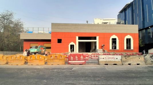
Langford Town, Bengaluru, is getting a metro station with its name on it, but the station isn’t technically in Langford Town. According to its official details, Langford Town metro station on the Pink Line is being built on Hosur Road at Muniswamy Garden in Neelasandra, just across the road. It’s a good example of how blurred the boundaries are between the old Cantonment neighbourhoods south of Richmond Town.
Langford Town is a leafy, low-density pocket from the colonial era, close to Bengaluru’s central business district. Here’s where it sits, how to get around, and what’s nearby.
Langford Town at a Glance
| Detail | Information |
| Era | British Cantonment period |
| Character | Low-density, tree-lined streets with heritage villas and boutique apartments |
| Main roads | Hosur Road, Langford Road, Richmond Road |
| Key junction | Nanjappa Circle |
| PIN code | 560025 (some addresses use 560027 or 560047) |
| Upcoming metro | Langford Town (Pink Line, underground) |
| Current metro | MG Road and Trinity (Purple Line), about 2.5 km |
| Landmark | Baldwin Boys’ High School on Hosur Road |
We couldn’t find a reliable source for who Langford Town is named after, so we haven’t included a name origin here.
A Colonial-Era Neighbourhood
Like Richmond Town, Cleveland Town and Benson Town, Langford Town is known for its colonial design. Today it’s a mix of:
- Heritage villas: Some older independent homes survive on quiet streets.
- Boutique apartments: Low-rise, high-end apartment buildings have replaced many older homes.
- Tree-lined streets: The inner streets are much greener and quieter than the main roads.
Getting Around Langford Town, Bengaluru
Metro: Langford Town Station (Coming Soon)
- Line: Pink Line, which runs 21.25 km from Kalena Agrahara on Bannerghatta Road to Nagawara on the Outer Ring Road.
- Station type: Underground, located on Hosur Road at Muniswamy Garden, Neelasandra.
- Neighbouring stations: National Military School towards Nagawara, and Lakkasandra towards Kalena Agrahara.
- Opening estimate: The underground Dairy Circle–Nagawara section is expected around December 2026. The Pink Line has missed earlier deadlines, so allow for delays.
- Interchanges: MG Road (Purple Line), Jayadeva Hospital (Yellow Line), Nagawara (Blue Line) and JP Nagar 4th Phase (Orange Line).
Metro: Available Now
- MG Road and Trinity: Purple Line stations about 2.5 km away, the nearest operational metro for now.
Buses
Routes serving the area include B2 (Peenya 2nd Stage to Electronic City), G2 (Brigade Road to Electronic City Wipro Gate), G4 (Brigade Road to Bannerghatta National Park), MBS13 and P7D. Useful stops include Nanjappa Circle, Langford Town, Hockey Stadium, Baldwin Boys High School and Gajendranagar Cross.
Travel Times by Road
Based on one estate agent’s estimates:
- MG Road/CBD: 10–20 minutes.
- Electronic City: 35–55 minutes.
- Outer Ring Road (Bellandur) and Manyata Tech Park: 40–65 minutes.
- Whitefield: 60–90 minutes.
- Airport: 55–80 minutes.
Traffic and Local Issues
Residents’ reviews point out a few problems:
- Langford Road: It connects KH Road (Double Road) to Hosur Road and is one of the area’s most congested stretches, especially during the day.
- Metro construction: Some roads are in poor condition, with dust from ongoing work.
- Parking: Space is limited on many streets.
- Garbage and noise: Some residents report issues with garbage and noise along the main roads.
The inner streets, however, are described as calm and safe to walk at night, with few power cuts and plenty of supermarkets nearby.
Neighbouring Areas
- Richmond Town: Directly adjacent, established in 1883, and known for Johnson Market and the Bangalore Hockey Stadium.
- Shanthinagar: To the west, with the Shanthinagar bus depot and busy commercial streets.
- Wilson Garden: To the south, a large residential area.
- Austin Town and Neelasandra: To the east. Austin Town is famous for its football history, and Neelasandra is home to the new metro station.
- Lakkasandra and NIMHANS: Further south along Hosur Road, with the next Pink Line station and the NIMHANS hospital.
Schools and Landmarks
- Baldwin Boys’ High School: A historic school on Hosur Road, and a common landmark for directions.
- Bangalore Hockey Stadium: Nearby in Richmond Town.
- Nanjappa Circle: The main local junction and bus stop.
FAQs
Q1. Which metro station will serve Langford Town?
Langford Town station on the Pink Line, which is underground and under construction on Hosur Road at Neelasandra. It’s expected around December 2026, though delays are possible.
Q2. What is the nearest working metro to Langford Town?
MG Road and Trinity stations on the Purple Line, about 2.5 km away.
Q3. What is the PIN code of Langford Town?
Most addresses use 560025, under the Richmond Town post office. Some nearby streets use 560027 (Wilson Garden) or 560047 (Viveknagar).
Q4. Is Langford Town a busy area?
The inner streets are quiet and green, but Langford Road, between KH Road and Hosur Road, is one of the most congested stretches in the area during the day.