
Tangla Town, Assam, was once part of a trade route that stretched all the way to Tibet. Monpa traders from Tibet came down to Tangla and nearby Udalguri to buy a silk called Alaine from the Bodo and Rava communities, dyed and wove it in local villages, and carried the finished cloth back to Monpa villages in present-day Arunachal Pradesh and Tibet. The route passed through Trashigang and Dewangiri in Bhutan.
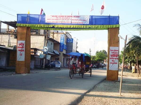
Today Tangla is a small, busy business town in Udalguri district, about 16 km from the Bhutan foothills, with a railway line running through its centre. Here’s where it is, how to get there, and what’s nearby.
Tangla at a Glance
| Detail | Information |
| District | Udalguri, Bodoland Territorial Region (BTR), Assam |
| Local body | Tangla Town Committee (established 1962) |
| Population (2011) | 17,183 |
| Area | 3.19 sq km |
| Distance from Bhutan foothills | About 16 km |
| Railway | Tangla station, Rangiya–Murkongselek line |
| Railway reached Tangla | 1912 |
| Nearby | Army brigade about 10 km north |
| Earlier district | Darrang |
A Town Shaped by Tea, Trade and the Army
According to the Bodoland urban development department, Tangla has been an important business centre from the start:
- Tea: About a century ago, the northern part of the area was dominated by the tea industry.
- Army: An army brigade is based about 10 km to the north.
- Railway: The railway station was set up to serve the tea industry, the army and local traders.
- Education: Tangla has a college, a postgraduate college, three junior colleges and many schools.
Tangla’s Railway History
- 1912: The railway was extended from Rangiya to Tangla, which became the end of the line.
- 1932–33: The line was extended from Tangla through Udalguri to Rangapara, and passenger trains started running in 1935. The district’s website gives the construction years as “1982-33,” which is clearly a typing error for 1932–33.
- Today: Tangla is on the 450 km Rangiya–Murkongselek broad-gauge line.
For about 20 years, Tangla was the northern railhead of this route.
Diesel or Electric?
Sources disagree. The overview of the Rangiya–Murkongselek line lists it as electrified, while station pages on nearby stops, like Khoirabari and Harisinga, still describe a single diesel line. The station pages were written earlier, so the line has probably since been electrified. Check with Indian Railways for the current status.
From Darrang to Bodoland
- Before 2003: Tangla and Udalguri were part of Darrang district.
- 10 February 2003: A peace agreement between the Bodo Liberation Tigers, the Government of India and the Government of Assam created the Bodoland Territorial Council.
- 2003–2004: Udalguri was notified as a district on 30 October 2003 and formally inaugurated on 14 June 2004.
- Today: Udalguri district is part of the Bodoland Territorial Region (BTR).
Getting to Tangla Town, Assam
By Rail
- Tangla station: On the Rangiya–Murkongselek line, with the tracks running through the middle of town.
- Neighbouring stations: Khoirabari to the west, and Harisinga, then Udalguri, to the east.
- Rangiya Junction: The nearest major junction, with trains to Guwahati and the rest of India.
By Road
Several roads pass through Tangla:
- Mangaldai–Bhootiachang Indo-Bhutan link road: Connects Tangla south to Mangaldai and north towards the Bhutan border.
- Tangla–Bhergaon road and Tangla–Deor road: Local links to surrounding towns.
- College Road: Links to the Mackenzie Road.
By Air
Guwahati’s Lokpriya Gopinath Bordoloi International Airport is the nearest major airport. Most travellers reach Tangla by road from Guwahati or by train via Rangiya.
Nearby Areas
Udalguri
The district headquarters and largest town, a few stations east. Its population was 15,279 in 2011, with a literacy rate of 88.33%.
Khoirabari and Harisinga
Nearby towns on the same railway line, each with its own station.
Mangaldai
The headquarters of Darrang district, to the south, connected by the Indo-Bhutan link road.
Bornadi Wildlife Sanctuary
Established in 1990 and covering about 26.22 sq km, the sanctuary is shared with neighbouring districts. It’s home to elephants, tigers, hog deer, the Bengal florican and the greater adjutant stork.
The Bhutan Border
The foothills are about 16 km north. Check current border crossing rules before planning a trip into Bhutan.
FAQs
Q1. Which district is Tangla in?
A. Tangla is located in Udalguri district, which is part of the Bodoland Territorial Region (BTR) in Assam. It was earlier part of Darrang district.
Q2. When did the railway reach Tangla?
A. The railway reached Tangla in 1912, when the line was extended from Rangiya. It was later extended to Udalguri and Rangapara in 1932–33, with passenger services beginning in 1935.
Q3. How far is Tangla from the Bhutan border?
A. Tangla is approximately 16 km from the Indo-Bhutan foothills. The Mangaldai–Bhootiachang Indo-Bhutan link road passes through the town.
Q4. What is the population of Tangla?
A. According to the 2011 Census, Tangla had a population of 17,183. The town covers an area of approximately 3.19 sq km.
Q5. What was Tangla’s historical link to Tibet?
A. Tangla had historical trading links with Tibet through Monpa traders. They travelled to Tangla and Udalguri to purchase Alaine silk from Bodo and Rava weavers and carried the finished cloth through Bhutan to Monpa villages and Tibet.