
Benson Town, Bengaluru, is named after a doctor rather than a general or tax collector. Dr P.H. Benson was a Durbar Surgeon in the princely state of Mysore, one of two royal physicians who gave their names to parts of the old Cantonment. The other was Sir John Colin Campbell, after whom Campbell Road is named.
Benson Town grew up in the late 19th century, when the Cantonment was expanding and new residential layouts were needed. It’s still one of the quieter corners of central Bengaluru, with tree-lined roads and old bungalows behind compound walls. Here’s a practical guide for anyone planning to live in, visit or move through the area.
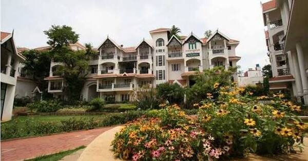
Benson Town: The Essentials
| Detail | Information |
| Official name | Kadamba Nagara, after the Kadamba dynasty |
| Named after | Dr P.H. Benson, Durbar Surgeon of Mysore |
| Developed | Late 19th century, as the Cantonment expanded |
| PIN code | 560046 |
| Old village name within the area | Byadarahalli |
| Main roads | Millers Road, Tannery Road, CV Raman Road, Cubbon Road |
| Upcoming metro | Pottery Town (Pink Line, underground) |
| Airport distance | About 27 km |
Why the Old Name Stuck
Like most of the Cantonment, Benson Town has an official Kannada name that almost no one uses. Kadamba Nagara honours one of Karnataka’s earliest ruling dynasties, but Benson Town is still the name on addresses, property listings and cab bookings.
A few other names worth knowing:
- Byadarahalli: An old village name still used in addresses, especially around Benson A Cross Road.
- Pottery Town: Named after potters who came from Madras. It’s right next door, and the boundary between the two is blurry.
- Nandi Durga Road: A common reference point for the northern part of the area.
The Metro Station That’s Partly in Benson Town
Most people assume Pottery Town metro station is in Pottery Town. Its official address, however, lists Byadarahalli, Pottery Town and Benson Town together. So, at least on paper, Benson Town is getting a metro station of its own.
Here’s where it stands:
- Station type: Underground, on the Pink Line.
- Railway connections: It’s designed to link with Bengaluru East and Banaswadi railway stations.
- Neighbouring stations: Tannery Road to the north and Cantonment to the south.
- Opening estimate: Station pages say around December 2026, but the Pink Line’s overall timeline points to around March 2027.
- Current status: Still under construction as of late September 2026.
Once it opens, the Pink Line will give Benson Town direct connections to MG Road, Shivajinagar and Nagawara, with interchanges to the Purple and Yellow lines.
Getting Around Benson Town, Bengaluru
Roads
Benson Town is well connected by some of central Bengaluru’s older roads:
- Millers Road: The main road through the area, connecting towards Vasanth Nagar and Cunningham Road.
- Tannery Road: Runs north towards Richards Town and Nagawara.
- CV Raman Road: Useful for heading towards Sadashivanagar and the north-west.
- Cubbon Road: Leads towards the city centre and MG Road.
Two Local Problems to Know About
Residents’ reviews highlight a couple of recurring issues:
- Millers Road: Broken utility chambers have caused traffic slowdowns.
- Tannery Road: It floods after heavy rain, which can make it difficult to use during the monsoon.
If you’re looking at a flat, drive both roads after a heavy downpour before you decide.
Rail
Bengaluru East railway station is close by. It reopened to passengers on 25 May 2026 after track work and has trains towards Chennai and Kolar Gold Fields. Bengaluru Cantonment station is also nearby, although it’s undergoing a major redevelopment.
Buses and Cabs
BMTC buses run along Millers Road and Tannery Road. Autos and app cabs are easy to find, and short trips to Frazer Town, Vasanth Nagar and MG Road are usually quick outside peak hours.
To the Airport
Kempegowda International Airport is about 27 km away. The drive usually goes via Hebbal and NH 44, and it can take much longer during peak hours.
Neighbourhoods Nearby
Frazer Town
Frazer Town is to the east and is known for its restaurants on Mosque Road. A lot of Benson Town residents go there to eat, especially during Ramzan.
Pottery Town
Pottery Town is right next door, and it’s hard to tell where one ends and the other begins. It has the new metro station and older lanes linked to the potters who gave it its name.
Cooke Town and Richards Town
Both are to the north-east, across Tannery Road. They’re quieter, residential Cantonment neighbourhoods with colonial histories similar to Benson Town’s.
Vasanth Nagar
Vasanth Nagar is to the west, along Millers Road and Thimmaiah Road. It’s home to several colleges, offices and the Palace Grounds area.
Williams Town and Sagayapuram
These denser, busier neighbourhoods are to the north. They have local markets and schools and are more affordable than Benson Town.
What It’s Like to Live Here
Here’s a quick overview for anyone thinking of renting or buying:
- Atmosphere: Quiet, leafy and residential, with rain trees, old houses and churches. One writer described it as the part of Bangalore that “did not feel the need to shout.”
- Housing: A mix of old bungalows and newer apartment buildings. According to 99acres, apartment prices rose about 10% over a recent one-year period.
- Tenants: Rentals are competitive, and the area’s closeness to central offices makes it popular with working professionals.
- Schools: Several schools are within 3 km, including Wisdom International School and a government school.
- Drawbacks: Waterlogging on Tannery Road and traffic on Millers Road are the most common complaints.
FAQs
Q1. What is the official name of Benson Town?
A. Kadamba Nagara, after the ancient Kadamba dynasty. Most people still call it Benson Town, after Dr P.H. Benson, a Durbar Surgeon of Mysore.
Q2. Which metro station is closest to Benson Town?
A. Pottery Town on the Pink Line, whose official address includes Benson Town. It’s still under construction, with opening estimates between December 2026 and March 2027.
Q3. Is Benson Town a good place to live?
A. It’s quiet, green and central, with good access to MG Road and Frazer Town. The main drawbacks are flooding on Tannery Road and traffic on Millers Road.
Q4. How far is Benson Town from Bengaluru Airport?
A. About 27 km. The drive usually goes via Hebbal and NH 44 and can take much longer during peak hours.