
Udalguri Town, Assam, is named after a tree. According to local legend, the area once had so many Odal (Udal) trees that the town took its name from them, with “guri” meaning the surrounding area. Bodo speakers still call it Odalguri. From this small district headquarters, a 32 km drive north leads to a riverbank where three rivers and three borders meet.
That spot is Bhairabkunda, on the edge of Bhutan and Arunachal Pradesh, and it’s Udalguri’s best-known attraction. Here’s where the town sits, how to get there, and what’s nearby.
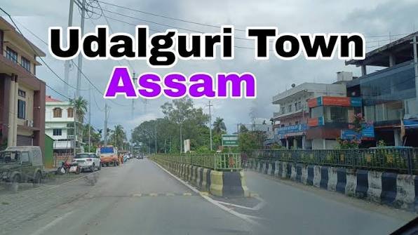
Udalguri Overview
| Detail | Information |
| Name meaning | “Area around the Udal tree” (Bodo: Odalguri) |
| Role | Headquarters of Udalguri district, Bodoland Territorial Region |
| Civic body | Udalguri Municipal Board |
| Town area | About 4.69 sq km |
| Town population (2011) | 15,279 |
| Literacy | 88.33% |
| District area | About 1,852 sq km |
| District population (2011) | 8,32,769 |
| Distance from Guwahati | About 140 km |
| Railway | Udalguri station, Rangiya–Murkongselek section |
| Bus stand | Golma Bus Stand |
| Vehicle registration | AS-27 |
Where Udalguri Sits
Udalguri district is on the north bank of the Brahmaputra. Its borders:
- North: Bhutan and West Kameng district of Arunachal Pradesh.
- East: Sonitpur district.
- South: Darrang district.
- West: Wikipedia names Tamulpur district, while older sources list Baksa. Tamulpur was carved out of Baksa more recently, which explains the difference.
Bhairabkunda: Where Three Borders Meet
- Location: On the India–Bhutan border, near where Arunachal Pradesh also meets Assam.
- Rivers: The Jia Dhansiri, Bhairavi and Daifam rivers meet here.
- Crossing into Bhutan: Wikipedia says visitors can walk across the border to the Bhutanese town of Daifam. Check current rules before you go, as border procedures can change.
- Shiva temple: The Bhairabkunda Shiva Mandir is actually in Bhutan, just across from Bhairabkunda.
- Festival: The Bhairabkunda Tourism Festival is held every January on the banks of the Dhansiri.
- Gethsemane man-made forest: A planted forest near Bhairabkunda, popular with picnickers.
- Distance: About 32 km from Udalguri town.
Daifam was once a growing Bhutanese town, but local sources say its growth slowed after unrest in Bhutan in the late 1980s.
Getting to Udalguri Town, Assam
By Rail
- Udalguri station: In the heart of town, on the Rangiya–Murkongselek section of the Northeast Frontier Railway.
- Directions: Trains run west towards Rangiya Junction, which has connections to Guwahati, and east towards Upper Assam and Dhemaji district.
- Rowta Bagan: Another station in the district, about 2.5 km north of Rowta Chariali, with trains to Guwahati, Tezpur, Rangapara, Biswanath Chariali and Dhemaji.
By Road
- Highways: Udalguri is connected to Guwahati and Tezpur by the national highway, which local sources still refer to as NH 52.
- From Guwahati: About 140 km via Darrang and Kamrup districts.
- Buses: The Assam State Transport Corporation, Bodoland Transport Services and private operators run buses between Guwahati and Tezpur via the district.
By Air
- Guwahati (LGBI Airport): The main airport, with the most flight options.
- Tezpur Airport: Closer for the eastern parts of the district, but with fewer flights.
Nearby Areas
- Tangla: A trading town in the district, once part of the Tibet–Bhutan silk trade route.
- Rowta Chariali: A town on the Dhansiri River with its own railway station.
- Khoirabari and Harisinga: Other railway towns in Udalguri district.
- Dimakuchi: Near the Bhutan foothills, known for its tea estates.
- Mangaldai: The Darrang district headquarters, to the south.
- Daifam (Bhutan): Across the border from Bhairabkunda.
Places to Visit in Udalguri Town
- Namghar: A traditional Assamese prayer house.
- Hanuman Temple: A local landmark in town.
- Baptist Church: One of several churches serving the district’s diverse communities.
FAQs
Q1. What does Udalguri mean?
It means “the area around the Udal tree,” from “Udal” (a tree) and “guri” (surrounding area). Bodo speakers still call it Odalguri.
Q2. What is Bhairabkunda?
A picnic spot on the India–Bhutan border, about 32 km from Udalguri, where the Jia Dhansiri, Bhairavi and Daifam rivers meet. It hosts a tourism festival every January.
Q3. How far is Udalguri from Guwahati?
About 140 km by road via Darrang and Kamrup districts. Trains also connect Udalguri to Guwahati via Rangiya Junction.
Q4. Can you cross into Bhutan from Bhairabkunda?
Wikipedia says visitors can walk across to the Bhutanese town of Daifam. Rules can change, so check with local authorities before planning a crossing.